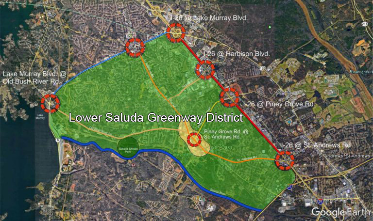
The boundaries of the Lower Saluda Greenway District will connect at the St. Andrews Road Corridor. This unincorporated area of Lexington County was originally named “Whitehall” after one of the original residential developments at the heart of the Corridor. As the Town of Irmo developed to the north of Whitehall, the Corridor lost its identity.
It is clear that an important aspect of the study is to rebrand the area as a District with defined boundaries and a distinct name: the Lower Saluda Greenway District.
The boundaries of the Lower Saluda Greenway District are defined by several important landmarks:
The Saluda River as the Western boundary; Interstate 26 to the East; Interstate 20 as the South Boundary; and Lake Murray Boulevard to the North, with St. Andrews Road being the connecting spine in the center of the district.